
Tinley Park Neighbors by Source
A block search can show land, public names tied to parcels, district context, and dated events. It cannot produce a current household roster. Tinley Park crosses Cook and Will County, so the first task is to place the target address in the right county and township. Then use the matching parcel map. Keep direct adjacency separate from membership in the same subdivision or service district. Even a parcel across the road may lie in another county, town, or district.
| Source | What It Shows About a Block | Access |
|---|---|---|
| CookViewer or Will GIS | Parcel shape, address, map proximity, roads, and selected layer date | Free county viewers |
| County property roll | Owner or taxpayer label, PIN, situs, and mailing details | Free assessor portals |
| Village permit and board records | Address event, project, applicant or contractor role, and date | Portal, public packet, or FOIA |
| Association documents | Community name, public rules, minutes, contacts, or entry-sign work | Public page; no private roster |
| Historic maps and directories | Past names, businesses, structures, and street context | Library online or in person |
An assessor name is a property role, not proof that the person lives there. A mailing address that matches the parcel location may support an owner-occupancy lead, but it still does not identify all members of a home. The same care applies to permits, where the named person may be an applicant or contractor. State voter files do not solve the gap: Illinois redacts the public street number and bars personal or private use. Public records can frame the block around your neighbors without exposing a private list of occupants.
Select Tinley Park Parcels First
On the Cook side, CookViewer is the strongest nearby-parcel tool. Search the target by address or PIN, then click the parcel before opening the Nearby or adjacent search. Choose parcels as the source layer, set the radius or distance, and record the result count. Save the highlighted selection and any “No Nearby Parcels Found” message. A generated map report is a dated map view, not a title record.
After the map identifies the lots, open the Cook County Assessor search for each parcel that matters. Preserve the Property Location label, PIN, taxpayer or owner field, township, mailing address, and capture date. Cook itself warns that Property Location is not the legal description or postal mailing address. That quirk matters when trying to tell whether two records point to the same place.
Use the map for proximity and the assessor for a property association. Neither source alone proves who your Tinley Park neighbors are today.
Will Maps Place Tinley Park Neighbors
The Will County GIS Data Viewer should be read layer by layer. Turn on parcels, address points, streets, municipal limits, and zoning separately, then note each update statement. Address points help confirm that the county recognizes a situs. Parcel geometry shows lot boundaries. Municipal limits explain why a Tinley Park mailing label may not settle the government jurisdiction.
Use the Will Supervisor of Assessments Address Search to match street number, street name, and city. Its results use county 9-1-1 addressing, and the county provides a discrepancy route when the address does not align. A PIN search can then preserve the parcel key. If a result lies near the Cook boundary, do not assume every nearby lot belongs in Will.
Map layers give geographic context, not a social link. Two owners may share a fence line without sharing a household, subdivision, or service district.
Map a Tinley Park Block
Keep the scope tight: the parcel itself, the lots that touch it, and a clearly stated radius if more context is needed. This avoids turning a block search into an unsupported list of people along a whole road. Record the county, selected layer, date, and relationship to the target for each result.
- Verify the full address and county. Search CookViewer or Will GIS and save the parcel or PIN, municipality, township, and visible street label.
- Select the target parcel before searching nearby. Click each adjoining parcel and note whether it directly touches the target or merely falls within the chosen radius.
- Open each relevant assessor card. Compare the property location with its mailing field and retain the owner or taxpayer wording, without recasting it as occupancy.
- Add a subdivision plat, public association document, permit, or historic map only when it answers a clear question about the block. Record its date and role.
A broader road project belongs in the Tinley Park street directory, which follows the address and deed chain along a named street. The block method stays focused on your nearest parcels and their public context. This distinction also helps avoid treating all homes on a long road as neighbors.
Tinley Park Association Record Leads
Public association pages can identify a community and its record route. They do not open private resident lists. Pheasant Lake's public material says the townhome association was established in 1994, with 27 buildings and 92 units. It offers board, minutes, rules, and exterior-change material. Trinity Creeks publishes a management contact. Village records mention Lakeview in a dated contract table and Brookside Glen in connection with subdivision entry signs.
Use public minutes, rules, and project records to date community actions. Do not infer unit occupants.
Use the public management page to reach the community record contact. No member list is published.
Search village contracts and ordinance records by association or subdivision name for date-specific public acts.
A minute proves that a board acted on a date. An entry-sign record links an association to a place. Neither fact identifies all Tinley Park neighbors in the community. Save the public page title, URL, access date, and the exact statement used because these sites can move or disappear.
Tinley Park Districts Are Not Rosters
Precinct, school, park, fire, library, zoning, and other district layers help describe a block. They can show which office may hold a map or public meeting record. They cannot identify everyone at an address. Illinois voter law reinforces that distinction. The public file may include street name, city, ZIP, county, precinct, and district fields, but street number and sensitive identifiers are redacted, and personal or private use is prohibited.
A district line may also change after redistricting or annexation. Preserve the election or map date rather than overwriting old geography with a new layer. Village subdivision and road-jurisdiction records around 159th, 171st, 185th, and 191st Streets can give useful date-specific context. Historic 175th Street and Thornton Road labels are further proof that road names must match the source era.
For block history, Tinley Park Public Library offers maps, Bell directories, newspaper microfilm, and local-history items. These sources can show an older structure, subscriber, or business, but not a current household.
Official and Commercial Neighbor Results
Official sources are narrower but state the record role. Commercial neighbor tools often merge names, phones, and address histories without showing when a field changed or which office supplied it. That can make the result look complete while hiding stale data and same-name errors.
| Source Type | Useful For | Main Limit |
|---|---|---|
| County GIS and assessor | Parcel proximity, owner or taxpayer role, map date | Does not establish present occupancy |
| Village and association records | Dated project, subdivision, rule, or public contact | No private member or household roster |
| Commercial lookup category | Possible lead to check elsewhere | May be old, merged, mislabeled, or paywalled |
Return any outside lead to a county, state, village, library, or other primary source. Do not republish a broad list simply because a service displays one.
Tinley Park Neighborhood Safety Search
For a defined personal-safety question, use the official Illinois State Police Sex Offender Registry. The observed registry offers name, date of birth, city, ZIP, county, status, offender type, and a map-neighborhood route. It is updated as an official status source, but users must accept its disclaimer and read each result within the registry's limits.
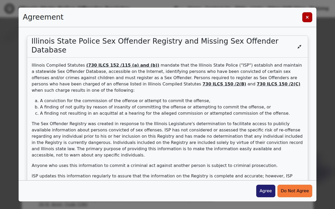
The captured controls show why the registry should be searched directly rather than through a copied list. Save the search date, status, and official record identifiers, and never infer facts that the result does not state.
This official route is distinct from parcel mapping. A map can place a public registry result in geographic context, but it does not add new people or private facts to that record.
Protect Tinley Park Neighbors' Privacy
Public records do not expose a complete block. Utility customers, delivery data, driver records, private association rosters, and household members are not public neighbor lists. Court files may be sealed, police records can protect victims or active matters, and vital certificates remain eligibility-controlled. The Illinois Address Confidentiality Program can place a substitute address in new government interactions for eligible participants.
The program cannot remove old public records or guarantee that property records stay hidden. That is a reason for restraint, not an invitation to join old and new data to uncover someone. If a source is wrong, send the correction to the county, village, court, registry, or association that controls it. A commercial opt-out does not change the primary record.
Lawful use. Search Tinley Park neighbors only for lawful personal, civic, or safety reasons. Never watch, threaten, stalk, harass, or intimidate another person.