
Walk a Tinley Park Street
A sound Tinley Park street directory result is a chain of records, not one list. Each source assigns a narrow role to a name. The assessor links a taxpayer or assessed owner to a parcel. A deed identifies grantors and grantees in a transfer. A phone directory records a subscriber. A permit names an applicant or contractor. Keep those labels intact.
County comes first because Tinley Park crosses Cook and Will. Save the exact address, township, parcel identification number, and source date at each stop. Then follow the same sequence for every address on the street. That prevents a nearby map point or a shared postal city from being mistaken for the target parcel.
- Verify the mailing form with USPS, while remembering that postal lookup does not confirm any person at the address.
- Search the Cook Assessor or Will Supervisor of Assessments. Save all unit choices and the parcel number.
- Open CookViewer or Will GIS, select the parcel, and note township, boundary, road, and adjacent-parcel context.
- Use the parcel number and legal description in the correct recorder index. Keep each deed role and date separate.
- Check tax and permit records, then use dated local directories only when the question concerns an earlier household.
This street-by-street method is slower than copying names from a map. It is also much less likely to merge two addresses, two counties, or two people with the same name.
Tinley Park Street Search Fields
The Cook County Assessor Property Search has a literal address form. Street names go in without suffixes such as Avenue, Street, or Place. Direction and unit are separate controls. A known PIN, the parcel identification number, is often a safer key than a typed address.
| Cook field | Required | How to enter it |
|---|---|---|
| House Number | Yes in address mode | Numeric street number |
| Direction | No | Choose the displayed directional value |
| Unit Number | No | Use the condo or apartment identifier |
| Street Name | Yes | Omit Ave, St, Pl, and similar suffixes |
| City | Yes | Use the assessor's exact city label |
| CAPTCHA | When shown | Complete it before search |
An advanced owner-name route also exists. Still, the street directory should begin by address. Cook's parcel card warns that “Property Location” is not the legal description or postal mailing address. An assessed owner or exemption entry is public parcel data, not a current household roster.
Map Tinley Park Street Parcels
The CookViewer map accepts parcel, PIN, address, and intersection searches. Select the target parcel before using Nearby Search. Record the chosen source layer, distance, result count, highlighted parcels, and map date. A blank nearby result can reflect the tool settings, so it does not prove an empty block.
The captured CookViewer screen shows the search controls and parcel context used in a Tinley Park street directory search.
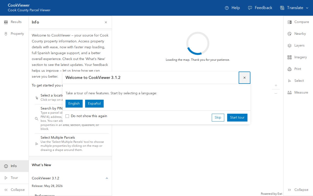
Parcel shape and district layers help distinguish direct adjacency from a parcel across a road, rail line, or municipal boundary. The generated report is a map view, not a deed or boundary survey.
- Parcel
- A mapped unit of land with its own county identifier.
- Situs address
- The location used to place property on the ground, which can differ from its mailing address.
- Plat
- A recorded map that divides land into lots, blocks, roads, or easements.
- Criss-cross directory
- A directory arranged by street or phone number instead of only by surname.
Tinley Park Records by Address
No one source answers every street question. Cook and Will portals can return different record types for the same Tinley Park mailing label. The table keeps each source's purpose and limit visible.
| Address source | Official keeper | Useful result | Main limit |
|---|---|---|---|
| Assessment | Cook Assessor or Will SOA | PIN, property location, assessed owner, value | Does not prove occupancy |
| Parcel map | CookViewer or Will GIS | Shape, nearby parcels, roads, districts | Not a legal survey |
| Recording index | Cook Clerk or Will Recorder | Deed parties, document number, transfer trail | Transaction index, not resident roll |
| Tax portal | County treasurer systems | Tax year, bill, legal-description cross-check | Payer may not be occupant |
| Permit record | Tinley Park BS&A or village files | Project, date, applicant, contractor | Role may not be resident |
| Voter source | State and county election offices | Registration or district lead | Use and disclosure are regulated |
The PIN and legal description join the assessment, map, tax, and deed sources. A street name joins permits and dated directories, but names and numbers can change. Preserve what each original record says before comparing it with another.
Will County Tinley Park Streets
The Will County Address Search uses Street Address Number, Street Name, and City/Town. The county notes that the address data are maintained for 9-1-1 addressing. A number-only or name-only query can return all records containing that value, which helps when the precise format is uncertain.
After the address result, use the separate Will PIN Search. It accepts a full or partial parcel identifier, with dashes optional, and displays the segments. Will formats may appear with 16 digits or a shortened form. Save the raw value rather than forcing it into Cook's 14-digit pattern.
Will's recorder route matters next. The official Ways to Search page explains free Direct Search, paid Tapestry and Laredo, and office access. Its address mode splits the house number from the street name and omits suffixes.
The successful Will Recorder capture shows its search choices and coverage guidance.
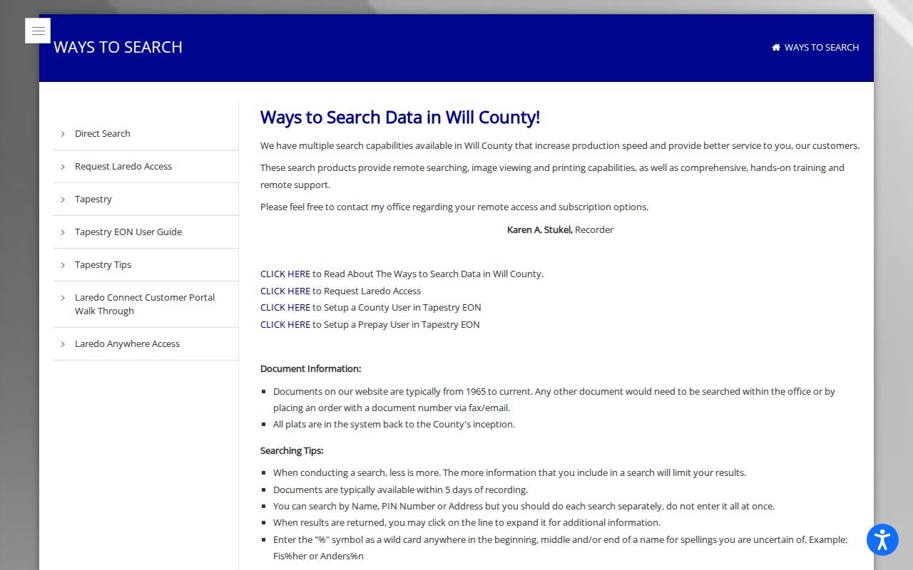
Web documents generally begin in 1965, while plats reach county inception. Older deeds route to office research workstations, microfilm, indexes, maps, or an archive copy request.
Tinley Park Deeds Along Streets
A deed chain turns one parcel into a dated street timeline. Begin with the current grantee, the person or entity receiving title. Read the grantor, legal description, PIN, recording number, recording date, and any prior-instrument reference. Then search that grantor as an earlier grantee. Mortgages, releases, liens, easements, and plats are distinct events and should not be described as sales.
Cook recording functions moved from the Recorder of Deeds to the Cook County Clerk on December 7, 2020. Older citations may still name the Recorder. Will County kept a separate Recorder, and its public web span is clearer. This is a useful comparison when a Tinley Park street directory search suddenly stops online.
Record transition. “Not online” can mean the index moved, remains on microfilm, or needs an office request. It does not mean no deed exists.
Old Tinley Park Street Names
Tinley Park records span Batchelor's Grove, Bremen, New Bremen, and the modern village name. Local sources also connect 175th Street with Thornton Road. The railroad and the 1853 Bremen plat shaped the early grid, while later village actions affected Oak Park Avenue and roads such as 159th, 171st, 185th, and 191st.
No complete official renumbering crosswalk was found. Test the name printed in the source era, then compare the legal description, lot and block, township, railroad, creek, and neighboring structures. Modern USPS wording should never be silently substituted into an old deed, map, or newspaper notice.
For past occupancy, the detailed Bell volumes and local collections belong on the Tinley Park city directory page. Here, those dated names are used only to test an address found in the parcel and deed chain.
Tinley Park Permit Address Events
The Tinley Park BS&A portal can add building or business-permit events by address, name, PIN, project, status, and date where the record is available. The applicant may be an owner, contractor, business representative, or other party. State the role exactly.
If the portal omits the needed record, ask the Village through its FOIA route for an existing series and date range. A focused request for permits or code records at a named address is different from asking staff to compile every person on a street. Illinois FOIA opens existing public records subject to exemptions; it does not require a new household list.
Note: Save the permit number and department because names alone are weak join keys in a street directory.
Verify Tinley Park Address Identities
One place can have a situs identity, legal description, mailing address, postal label, and map point. Tinley Park also uses the 60477, 60487, and 60478 labels, but ZIP geography does not establish county or village limits. Use the USPS ZIP Lookup for delivery wording, then return to the county parcel system for county, township, and PIN.
When those sources disagree, keep both results with their dates. A mailing update does not change Cook's Property Location, and a road label can change without a move. The deed's legal description and recorded plat provide the strongest continuity for older property research.
Tinley Park Street Directory Limits
There is no official complete Tinley Park street-by-street household table. Utility, motor-vehicle, and private association lists are not substitutes. Voter information is controlled by Illinois law, and public display can redact street numbers or other details. Police, vital, and court records can also be restricted or redacted.
A map proves parcel position. An assessment shows a property role. A deed records a transaction. A permit shows an address event. A directory records a dated subscriber or listed occupant. The Tinley Park street directory is reliable only when those roles remain distinct and two sources support any claim about a person.
Lawful use. Use Tinley Park address records for family history, property research, civic questions, or scam checks. Never use them to stalk, harass, threaten, or harm anyone.